How Directional Drilling Works in Houston Ground
Gumbo, water, and why trenchless is the local default
The metro sits on the Beaumont Formation — overconsolidated clays with sand lenses, the stuff locals call gumbo — with groundwater shallow enough that open excavation means dewatering almost anywhere. That single fact organizes the local underground trade: boring under obstacles usually beats fighting the water in an open cut, which is why Houston has been trenchless country since long before it was fashionable.
Gumbo steers beautifully and holds a bore well, but saturation changes the fluid mechanics: pressure you put in the annulus looks for exits through fissures and old sand lenses. Frac-out control in this metro is a discipline, not a disclaimer — conservative pressures, staged reaming, and eyes on the returns.
The sequence, and where Houston bends it
The bones are standard HDD: locates and potholing, pilot bore on profile, reaming to roughly one and a half times product diameter, pullback behind the final reamer, restoration. Houston bends the sequence at the edges — pits get shoring and pumps as a default, mud volumes run heavier, and disposal of wet returns is a planned cost line because saturated cuttings don't stack politely on a lawn.
Subsidence history gives this metro another quirk: decades of elevation change mean old as-builts lie about depth more than usual. We treat existing-utility depths as claims to verify by pothole, never facts to design around.
Who owns what you're crossing
City streets belong to their cities; unincorporated roads to the counties; state corridors to TxDOT under the utility-accommodation rules and its installation-request process. The drainage network belongs to the Flood Control District and drainage districts, whose channel ROW review governs the signature local crossing. Rail spurs feed everything industrial and run on railroad permits and flagging. Inside plant fences, the owner's permit-to-work system is the law. The quote names the authority and carries its clock.
How the number gets honest
Roughly 10,000 crossings quoted through our national intake taught one Houston-flavored lesson hard: the jobs that go wrong were priced dry. Water handling, returns disposal, shoring, ballast on the pull, district review time — the wet-ground lines are where a cheap quote hides its future change orders. Our scope sheet decomposes them up front and shows Pending Review until a person has priced your actual crossing; an instant number in this ground would be fiction.
Straight answers
How deep do bores run under Houston streets?
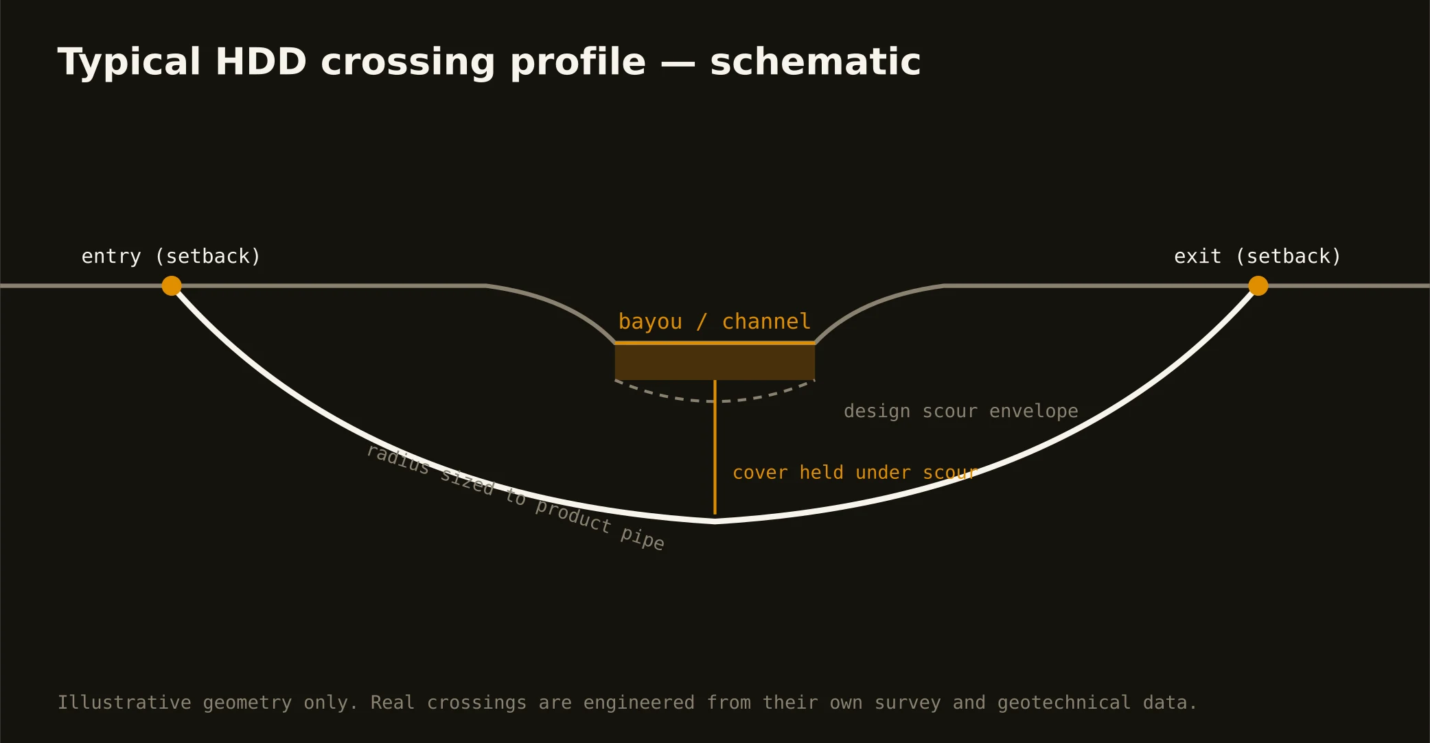
Cover is set by the authority's standard and what's already down there — several feet below pavement structure at minimum, below every potholed utility on the alignment, and deeper under channels where scour depth governs. The bore plan states the number for your crossing.
Is frac-out dangerous?
It's drilling fluid — bentonite and water — so the hazard is environmental and civic, not toxic: fluid where it doesn't belong, especially in a waterway. That's why crossings carry containment materials on site and a written response plan before the pilot starts.
Do you drill through sand?
Sand lenses inside the clay, yes — with mud designed to hold them open. Running sand that won't hold a hole is one of the honest 'HDD isn't the right method here' answers, and we give it when the ground says so.
Ready to put a number on a real crossing? Send the scope — a person prices it.